Sosa Icefalls Kjelder | Navigasjonsmeny81°51′S 157°48′E81°51′S 157°48′E«Sosa...
Isfall i AntarktisGeografi i Oates Land
Chapman snømarkChurchill MountainsMount MassamStarshotbreenUS Geological Survey
Koordinatar:
| Sosa Icefalls | |
isfall | |
| Land |  Antarktis Antarktis |
|---|---|
| Stad | Oates Land |
| - koordinatar | |
| Administrert under | Antarktistraktaten |
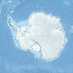  Sosa Icefalls (Antarktis) | |
Sosa Icefalls er ei rekkje isfall som er nesten 200 meter høge heilt sør i Chapman snømark i Churchill Mountains. Isfalla strekkjer seg sørvest for 22 km frå Mount Massam, og endar nær enden av Starshotbreen. Dei er kalla opp etter Ezekiel R. Sosa i US Geological Survey (USGS) ein topografiingeniør med landmålingsekspedisjonen i desse fjella, 1961-62.
Kjelder |
 Denne artikkelen inneheld stoff som er offentleg eige frå United States Geological Survey-artikkelen «Sosa Icefalls» (innhald frå Geographic Names Information System).
|


