Wunneburger Rock Kjelder | Navigasjonsmeny74°42′S 113°10′W74°42′S 113°10′W«Wunneburger...
Klippeformasjonar i Marie Byrd Land
Maunee forlandsbreKohlerbreenWalgreen CoastMarie Byrd LandUS Geological SurveyU.S. NavyAdvisory Committee on Antarctic NamesByrd-stasjonen
Koordinatar:
| Wunneburger Rock | |
| klippe | |
| Land |  Antarktis Antarktis |
|---|---|
| Stad | Marie Byrd Land |
| - koordinatar | |
| Administrert under | Antarktistraktaten |
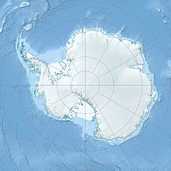  Wunneburger Rock (Antarktis) | |
Wunneburger Rock er eit isolert klippeframspring i Maunee forlandsbre ved den nedre Kohlerbreen på Walgreen Coast i Marie Byrd Land. Det vart kartlagt av US Geological Survey (USGS) frå landmålingar og flyfoto tekne av U.S. Navy i 1959-66. Klippa vart namngjeven av Advisory Committee on Antarctic Names (US-ACAN) etter Henry E. Wunneburger i US Navy, som var kokk ved Byrd-stasjonen vinteren 1966.
Kjelder |
 Denne artikkelen inneheld stoff som er offentleg eige frå United States Geological Survey-artikkelen «Wunneburger Rock» (innhald frå Geographic Names Information System).
|


