McConnel Islands Sjå òg | Kjelder | Navigasjonsmeny66°29′S 65°51′W66°29′S...
Øyar i Graham LandLoubet Coast
Darbel BayKidd IslandsGraham LandFalkland Islands and Dependencies Aerial Survey ExpeditionUnited Kingdom Antarctic Place-Names CommitteeJames C. McConnel
| McConnel Islands | |
| øy | |
| Land |  Antarktis Antarktis |
|---|---|
| Koordinatar | |
  McConnel Islands (Antarktis) | |
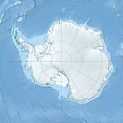
McConnel Islands er nokre øyar som ligg i Darbel Bay søraust for Kidd Islands, utanfor vestkysten av Graham Land i Antarktis. Ho vart fotografert av Falkland Islands and Dependencies Aerial Survey Expedition (FIDASE), 1956-57. Ho vart namngjeven av United Kingdom Antarctic Place-Names Committee (UK-APC) i 1960 etter James C. McConnel (1860–1890), ein engelsk fysikar som eksperimenterte med plastisk deformering av is i 1881-90.
Sjå òg |
- Antarktiske og subantarktiske øyar
Kjelder |
 Denne artikkelen inneheld stoff som er offentleg eige frå United States Geological Survey-artikkelen «McConnel Islands» (innhald frå Geographic Names Information System).
|


